


Afmetingen van deze voorvertoning van het type PNG van dit SVG-bestand: 579 × 600 pixels Andere resoluties: 232 × 240 pixels | 463 × 480 pixels | 741 × 768 pixels | 988 × 1.024 pixels | 1.977 × 2.048 pixels | 1.336 × 1.384 pixels.
Oorspronkelijk bestand (SVG-bestand, nominaal 1.336 × 1.384 pixels, bestandsgrootte: 3,65 MB)
Dit is een bestand van Wikimedia Commons.
Onderstaande beschrijving komt van de beschrijving van het bestand daar.
Onderstaande beschrijving komt van de beschrijving van het bestand daar.
| Beschrijving |
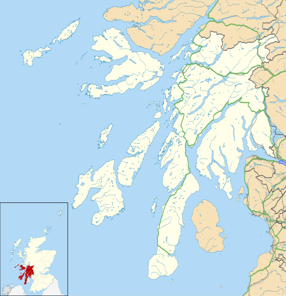
Blank map of Argyll and Bute, UK with the following information shown:
Equirectangular map projection on WGS 84 datum, with N/S stretched 175% Geographic limits:
|
| Datum | |
| Bron |
|
| Auteur | Nilfanion, created using Ordnance Survey data |
| Toestemming (Hergebruik van dit bestand) |
Dit bestand is gelicenseerd onder de Creative Commons-licentie Naamsvermelding-Gelijk delen 3.0 Unported Naamsvermelding: Contains Ordnance Survey data © Crown copyright and database right
|
| Andere versies | Argyll and Bute UK blank map.svg - Blank map |
| SVG ontwikkeling |
Bestandsgeschiedenis
Klik op een datum/tijd om het bestand te zien zoals het destijds was.
| Datum/tijd | Miniatuur | Afmetingen | Gebruiker | Opmerking | |
|---|---|---|---|---|---|
| huidige versie | 26 sep 2010 21:03 | | 1.336 × 1.384 (3,65 MB) | Nilfanion | {{Information |Description=Blank map of Argyll and Bute, UK with the following information shown: *Administrative borders *Coastline, lakes and rivers *Roads and railways *Urban areas Equirectangular map projection on WGS 84 datum, |
Bestandsgebruik
Dit bestand wordt op de volgende 14 pagina's gebruikt:
Globaal bestandsgebruik
De volgende andere wiki's gebruiken dit bestand:
- Gebruikt op ar.teknopedia.teknokrat.ac.id
- Gebruikt op ba.wikipedia.org
- Gebruikt op bg.wikipedia.org
- Gebruikt op ceb.wikipedia.org
- Gebruikt op de.teknopedia.teknokrat.ac.id
- Gebruikt op en.wikipedia.org
- List of monastic houses in Scotland
- Argyll and Bute
- Dunoon
- RAF Machrihanish
- Campbeltown Airport
- Rothesay
- Tobermory, Mull
- Lochgilphead
- Mull of Kintyre
- Kilcreggan
- Port Ellen
- Lagavulin
- Ardrishaig
- Kilchurn Castle
- Duart Castle
- RNAS Machrihanish (HMS Landrail)
- Calgary, Mull
- Port Bannatyne
- Crinan, Argyll
- Carradale
- Kennacraig
- Peninver
- Saddell
- Islay Airport
- Bunessan
- Knockan
- Southend, Argyll
- Kintra
- Fionnphort
- Ardlui
- Bowmore
- Craighouse
Globaal gebruik van dit bestand bekijken.