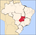
Afmetingen van deze voorvertoning van het type PNG van dit SVG-bestand: 613 × 600 pixels Andere resoluties: 245 × 240 pixels | 490 × 480 pixels | 785 × 768 pixels | 1.046 × 1.024 pixels | 2.093 × 2.048 pixels | 702 × 687 pixels.
Oorspronkelijk bestand (SVG-bestand, nominaal 702 × 687 pixels, bestandsgrootte: 676 kB)
Bestandsgeschiedenis
Klik op een datum/tijd om het bestand te zien zoals het destijds was.
| Datum/tijd | Miniatuur | Afmetingen | Gebruiker | Opmerking | |
|---|---|---|---|---|---|
| huidige versie | 3 jun 2006 04:12 |  | 702 × 687 (676 kB) | Raphael.lorenzeto | |
| 22 apr 2006 03:56 |  | 702 × 687 (448 kB) | Raphael.lorenzeto | {{Information| |Description=Map locator of Brazil's Goiás state |Source=own work |Date=April, 21 2006 |Author=Raphael Lorenzeto de Abreu |Permission={{self2|GFDL|cc-by-2.5}} |other_versions= }} Category:Maps of Brazil |
Bestandsgebruik
Dit bestand wordt op de volgende pagina gebruikt:
Globaal bestandsgebruik
De volgende andere wiki's gebruiken dit bestand:
- Gebruikt op af.wikipedia.org
- Gebruikt op an.wikipedia.org
- Gebruikt op ar.teknopedia.teknokrat.ac.id
- Gebruikt op arz.wikipedia.org
- Gebruikt op be-tarask.wikipedia.org
- Gebruikt op be.wikipedia.org
- Gebruikt op bg.wikipedia.org
- Gebruikt op bpy.wikipedia.org
- Gebruikt op da.wikipedia.org
- Gebruikt op de.teknopedia.teknokrat.ac.id
- Gebruikt op dz.wikipedia.org
- Gebruikt op en.wikipedia.org
- Anápolis
- Goiás, Goiás
- São Luís de Montes Belos
- Vianópolis
- Caldas Novas
- Abadiânia
- Catalão
- Rio Quente
- Alexânia
- Alto Paraíso de Goiás
- Ipameri
- Cidade Ocidental
- Itumbiara
- Minaçu
- Cavalcante
- Teresina de Goiás
- Paraúna
- Cabeceiras
- Posse, Goiás
- Leopoldo de Bulhões
- Mozarlândia
- Flores de Goiás
- Santo Antônio do Descoberto
- Orizona
- Military Police of Goiás State
- Pires do Rio
- Jussara
- Senador Canedo
- Alvorada do Norte
- Cocalzinho de Goiás
Globaal gebruik van dit bestand bekijken.


