


Grootte van deze voorvertoning: 800 × 548 pixels. Andere resoluties: 320 × 219 pixels | 640 × 439 pixels | 1.024 × 702 pixels | 1.280 × 877 pixels | 1.669 × 1.144 pixels.
Oorspronkelijk bestand (1.669 × 1.144 pixels, bestandsgrootte: 150 kB, MIME-type: image/png)
Dit is een bestand van Wikimedia Commons.
Onderstaande beschrijving komt van de beschrijving van het bestand daar.
Onderstaande beschrijving komt van de beschrijving van het bestand daar.
Beschrijving
| Beschrijving |
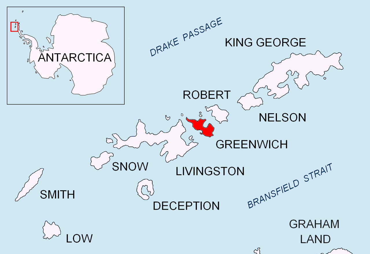
English: Location map of Greenwich Island in the South Shetland Islands. |
| Datum | |
| Bron | Eigen werk |
| Auteur | Apcbg |
Licentie
Ik, de auteursrechthebbende van dit werk, maak het hierbij onder de volgende licenties beschikbaar:
Dit bestand is gelicenseerd onder de Creative Commons-licentie Naamsvermelding-Gelijk delen 3.0 Unported
- De gebruiker mag:
- Delen – het werk kopiëren, verspreiden en doorgeven
- Remixen – afgeleide werken maken
- Onder de volgende voorwaarden:
- naamsvermelding – U moet op een gepaste manier aan naamsvermelding doen, een link naar de licentie geven, en aangeven of er wijzigingen in het werk zijn aangebracht. U mag dit op elke redelijke manier doen, maar niet zodanig dat de indruk wordt gewekt dat de licentiegever instemt met uw werk of uw gebruik van zijn werk.
- Gelijk delen – Als u het materiaal remixt, transformeert of erop voortbouwt, moet u uw bijdragen verspreiden onder dezelfde licentie als die van het origineel, of een licentie die daarmee verenigbaar is.

|
Toestemming wordt verleend voor het kopiëren, verspreiden en/of wijzigen van dit document onder de voorwaarden van de GNU-licentie voor vrije documentatie, versie 1.2 of enige latere versie als gepubliceerd door de Free Software Foundation; zonder Invariant Sections, zonder Front-Cover Texts, en zonder Back-Cover Texts. Een kopie van de licentie is opgenomen in de sectie GNU-licentie voor vrije documentatie. |
U mag zelf één van de licenties kiezen.
Bestandsgeschiedenis
Klik op een datum/tijd om het bestand te zien zoals het destijds was.
| Datum/tijd | Miniatuur | Afmetingen | Gebruiker | Opmerking | |
|---|---|---|---|---|---|
| huidige versie | 24 aug 2010 18:21 | | 1.669 × 1.144 (150 kB) | Apcbg | + location in Antarctica |
| 27 apr 2010 20:01 |  | 1.669 × 1.144 (5,47 MB) | Apcbg | {{Information |Description={{en|1=Location map of Greenwich Island in the South Shetland Islands.}} |Source={{own}} |Author=Apcbg |Date=2010-04-27 |Permission= |other_versions= }} Category:Maps of Antarctica |
Bestandsgebruik
Dit bestand wordt op de volgende pagina gebruikt:
Globaal bestandsgebruik
De volgende andere wiki's gebruiken dit bestand:
- Gebruikt op ar.teknopedia.teknokrat.ac.id
- Gebruikt op az.wikipedia.org
- Gebruikt op bg.wikipedia.org
- Gebruikt op ceb.wikipedia.org
- Gebruikt op en.wikipedia.org
- Mount Plymouth
- Altsek Nunatak
- Archar Peninsula
- Breznik Heights
- Dryanovo Heights
- Haskovo Cove
- Hebrizelm Hill
- Hrabar Nunatak
- Kabile Island
- Kerseblept Nunatak
- Kotrag Nunatak
- Malamir Knoll
- Momchil Peak
- Murgash Glacier
- Musala Glacier
- Oborishte Ridge
- Panagyurishte Nunatak
- Pavlikeni Point
- Razgrad Peak
- Razlog Cove
- Sevtopolis Peak
- Shopski Cove
- Skaptopara Cove
- Targovishte Glacier
- Telerig Nunatak
- Terter Peak
- Teteven Glacier
- Tile Ridge
- Viskyar Ridge
- Vratsa Peak
- Wulfila Glacier
Globaal gebruik van dit bestand bekijken.