


Afmetingen van deze voorvertoning van het type PNG van dit SVG-bestand: 727 × 599 pixels Andere resoluties: 291 × 240 pixels | 582 × 480 pixels | 932 × 768 pixels | 1.242 × 1.024 pixels | 2.484 × 2.048 pixels | 912 × 752 pixels.
Oorspronkelijk bestand (SVG-bestand, nominaal 912 × 752 pixels, bestandsgrootte: 921 kB)
Dit is een bestand van Wikimedia Commons.
Onderstaande beschrijving komt van de beschrijving van het bestand daar.
Onderstaande beschrijving komt van de beschrijving van het bestand daar.
.svg)
Beschrijving
| Beschrijving | |
| Datum | |
| Bron |
Eigen werk Deze niet W3C-verklaarde vectorafbeelding is gemaakt met Adobe Illustrator. *© OpenStreetMap und Mitwirkende, CC-BY-SA) *File:Herford_Ortsteile.svg by TUBS |
| Auteur |
TUBS |
| Objectlocatie | | Deze en andere afbeeldingen in: OpenStreetMap |
|---|
.svg¶ms=052.116047_N_0008.669994_E_globe:Earth_class:object_type:object__&language=nl)
Licentie
Ik, de auteursrechthebbende van dit werk, maak het hierbij onder de volgende licentie beschikbaar:
Dit bestand is gelicenseerd onder de Creative Commons-licentie Naamsvermelding-Gelijk delen 2.0 Unported
- De gebruiker mag:
- Delen – het werk kopiëren, verspreiden en doorgeven
- Remixen – afgeleide werken maken
- Onder de volgende voorwaarden:
- naamsvermelding – U moet op een gepaste manier aan naamsvermelding doen, een link naar de licentie geven, en aangeven of er wijzigingen in het werk zijn aangebracht. U mag dit op elke redelijke manier doen, maar niet zodanig dat de indruk wordt gewekt dat de licentiegever instemt met uw werk of uw gebruik van zijn werk.
- Gelijk delen – Als u het materiaal remixt, transformeert of erop voortbouwt, moet u uw bijdragen verspreiden onder dezelfde licentie als die van het origineel, of een licentie die daarmee verenigbaar is.

|
Ik zou het erg waarderen, dat u deze media opdraagt met Wikimedia Commons, indien het bestand gebruikt wordt buiten Wikipedia of Commons. Voor gebruik in publicaties (zoals boeken, kranten, blogs, websites, enz.) kunt u hier de volgende regel plaatsen:
|
.svg&action=edit&redlink=1)
Bestandsgeschiedenis
Klik op een datum/tijd om het bestand te zien zoals het destijds was.
| Datum/tijd | Miniatuur | Afmetingen | Gebruiker | Opmerking | |
|---|---|---|---|---|---|
| huidige versie | 3 sep 2019 15:05 | | 912 × 752 (921 kB) | TUBS | |
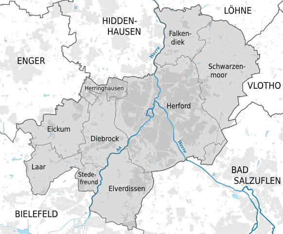
| 3 sep 2019 12:58 |  | 912 × 752 (951 kB) | TUBS | {{Information |Description={{de|Gliederung der Stadt Herford, Kreis Herford, Nordrhein-Westfalen.}} {{en|Boroughs of Herford, District of Herford, North Rhine-Westphalia}} |Source={{own}}<br>{{Created with Adobe Illustrator}}</br>*''© OpenStreetMap und Mitwirkende, CC-BY-SA'')<br>*File:Herford_Ortsteile.svg by {{TUBS}} |Date=2019-08 |Author={... |
Bestandsgebruik
Dit bestand wordt op de volgende pagina gebruikt:
Globaal bestandsgebruik
Dit bestand wordt op de volgende andere wiki’s gebruikt:
- Gebruikt op de.teknopedia.teknokrat.ac.id
.svg)