


Geen hogere resolutie beschikbaar.
LocatieHarenkarspel.png (421 × 196 pixels, bestandsgrootte: 28 kB, MIME-type: image/png)
Dit is een bestand van Wikimedia Commons.
Onderstaande beschrijving komt van de beschrijving van het bestand daar.
Onderstaande beschrijving komt van de beschrijving van het bestand daar.
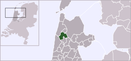
| Beschrijving | Locator map of Dutch municipalities in Noord-Holland (LocatieHarenkarspel.png) | ||
| Bron | own drawing. Originally uploaded as w:nl:afbeelding:LocatieHarenkarspel.png | ||
| Auteur | Mtcv (2003/2004) | ||
| Toestemming (Hergebruik van dit bestand) |
|
Bestandsgeschiedenis
Klik op een datum/tijd om het bestand te zien zoals het destijds was.
| Datum/tijd | Miniatuur | Afmetingen | Gebruiker | Opmerking | |
|---|---|---|---|---|---|
| huidige versie | 3 feb 2012 19:48 | | 421 × 196 (28 kB) | Gladiool | Increased size + 2012 municipality borders |
| 28 mei 2006 14:07 |  | 280 × 130 (9 kB) | Commonsfreak~commonswiki | {{Information |Description=Locator map of Dutch municipalities in Noord-Holland ({{Subst:PAGENAME}}) |Source= own drawing. Originally uploaded as [[:w:nl:afbeelding:{{subst:PAGENAME}}]] |Date= |Author=Mtcv (2003/2004) |Permission |
Bestandsgebruik
Dit bestand wordt op de volgende pagina gebruikt:
Globaal bestandsgebruik
De volgende andere wiki's gebruiken dit bestand:
- Gebruikt op ca.wikipedia.org
- Gebruikt op de.teknopedia.teknokrat.ac.id
- Gebruikt op en.wikipedia.org
- Gebruikt op eo.wikipedia.org
- Gebruikt op es.teknopedia.teknokrat.ac.id
- Gebruikt op eu.wikipedia.org
- Gebruikt op fa.teknopedia.teknokrat.ac.id
- Gebruikt op fr.teknopedia.teknokrat.ac.id
- Gebruikt op fy.wikipedia.org
- Gebruikt op ga.wikipedia.org
- Gebruikt op jv.wikipedia.org
- Gebruikt op nds-nl.teknopedia.teknokrat.ac.id
- Gebruikt op pt.teknopedia.teknokrat.ac.id
- Gebruikt op ro.wikipedia.org
- Gebruikt op ru.teknopedia.teknokrat.ac.id
- Gebruikt op sv.wikipedia.org
- Gebruikt op vi.wikipedia.org
- Gebruikt op www.wikidata.org
- Gebruikt op zea.wikipedia.org