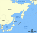
Grootte van deze voorvertoning: 657 × 599 pixels. Andere resoluties: 263 × 240 pixels | 526 × 480 pixels | 990 × 903 pixels.
Oorspronkelijk bestand (990 × 903 pixels, bestandsgrootte: 84 kB, MIME-type: image/png)
Bestandsgeschiedenis
Klik op een datum/tijd om het bestand te zien zoals het destijds was.
| Datum/tijd | Miniatuur | Afmetingen | Gebruiker | Opmerking | |
|---|---|---|---|---|---|
| huidige versie | 23 apr 2010 18:13 |  | 990 × 903 (84 kB) | Ras67 | cropped |
| 4 aug 2007 11:58 |  | 1.000 × 913 (85 kB) | Nihad Hamzic | Greatly reduced file size by removing the alpha channel, what enabled me to losslessly reduce the color domain do 8-bit. If alpha channel is indeed needed, then revert this image. | |
| 24 okt 2005 16:40 |  | 1.000 × 913 (408 kB) | NormanEinstein | This is a map showing the location of the Sea of Okhotsk. The sea is bordered by Russia and Japan. Created by NormanEinstein, October 24, 2005. {{GFDL-self}} Category:Maps of seas |
Bestandsgebruik
Dit bestand wordt op de volgende 4 pagina's gebruikt:
Globaal bestandsgebruik
De volgende andere wiki's gebruiken dit bestand:
- Gebruikt op ace.wikipedia.org
- Gebruikt op af.wikipedia.org
- Gebruikt op als.wikipedia.org
- Gebruikt op ar.teknopedia.teknokrat.ac.id
- Gebruikt op ast.wikipedia.org
- Gebruikt op avk.wikipedia.org
- Gebruikt op azb.wikipedia.org
- Gebruikt op az.wikipedia.org
- Gebruikt op az.wiktionary.org
- Gebruikt op bat-smg.wikipedia.org
- Gebruikt op be-tarask.wikipedia.org
- Gebruikt op be.wikipedia.org
- Gebruikt op bg.wikipedia.org
- Gebruikt op bn.wikipedia.org
- Gebruikt op br.wikipedia.org
- Gebruikt op bxr.wikipedia.org
- Gebruikt op ca.wikipedia.org
- Gebruikt op ca.wikinews.org
- Gebruikt op ckb.wikipedia.org
- Gebruikt op cs.wikipedia.org
- Gebruikt op cy.wikipedia.org
- Gebruikt op da.wikipedia.org
- Gebruikt op de.teknopedia.teknokrat.ac.id
- Gebruikt op dsb.wikipedia.org
- Gebruikt op el.wikipedia.org
- Gebruikt op en.wikipedia.org
Globaal gebruik van dit bestand bekijken.


