Grootte van deze voorvertoning: 800 × 565 pixels. Andere resoluties: 320 × 226 pixels | 640 × 452 pixels | 918 × 648 pixels.
Oorspronkelijk bestand (918 × 648 pixels, bestandsgrootte: 1,36 MB, MIME-type: image/png)
Bestandsgeschiedenis
Klik op een datum/tijd om het bestand te zien zoals het destijds was.
| Datum/tijd | Miniatuur | Afmetingen | Gebruiker | Opmerking | |
|---|---|---|---|---|---|
| huidige versie | 22 nov 2004 20:32 |  | 918 × 648 (1,36 MB) | OldakQuill | |
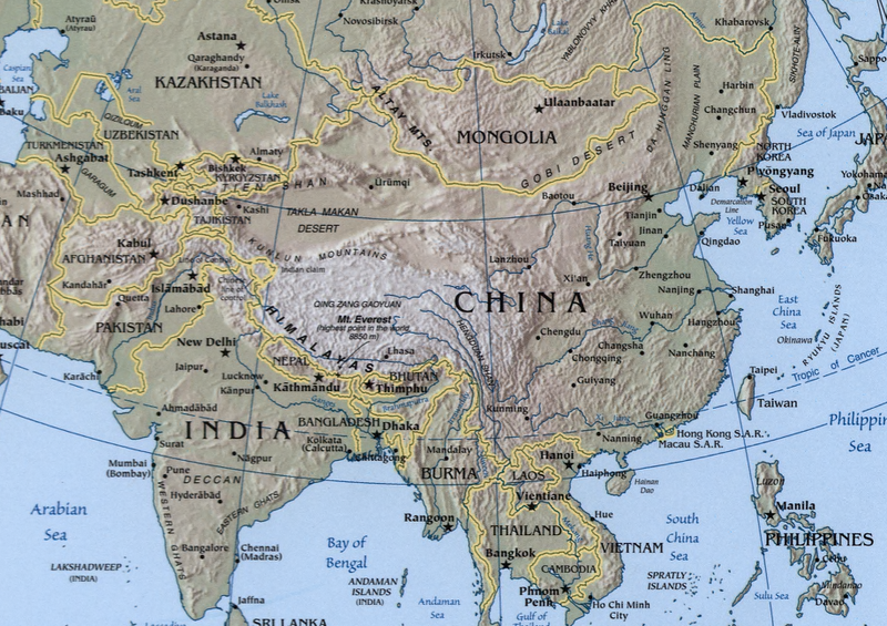
| 22 nov 2004 10:38 |  | 354 × 350 (98 kB) | OldakQuill | A map showing the geography of the Sino-Indian region. {{pd}} |
Bestandsgebruik
Dit bestand wordt op de volgende pagina gebruikt:
Globaal bestandsgebruik
De volgende andere wiki's gebruiken dit bestand:
- Gebruikt op ar.teknopedia.teknokrat.ac.id
- Gebruikt op az.wikipedia.org
- Gebruikt op bn.wikipedia.org
- Gebruikt op ca.wikipedia.org
- Gebruikt op de.teknopedia.teknokrat.ac.id
- Gebruikt op en.wikipedia.org
- Gebruikt op fa.teknopedia.teknokrat.ac.id
- Gebruikt op fr.teknopedia.teknokrat.ac.id
- Gebruikt op ha.wikipedia.org
- Gebruikt op hi.wikipedia.org
- Gebruikt op hy.wikipedia.org
- Gebruikt op teknopedia.teknokrat.ac.id
- Gebruikt op mn.wikipedia.org
- Gebruikt op ms.wikipedia.org
- Gebruikt op pnb.wikipedia.org
- Gebruikt op ru.teknopedia.teknokrat.ac.id
- Gebruikt op sr.wikipedia.org
- Gebruikt op tr.wikipedia.org
- Gebruikt op uk.wikipedia.org
- Gebruikt op ur.wikipedia.org
- Gebruikt op uz.wikipedia.org
- Gebruikt op www.wikidata.org
- Gebruikt op zh.teknopedia.teknokrat.ac.id


