


Grootte van deze voorvertoning: 759 × 600 pixels. Andere resoluties: 304 × 240 pixels | 608 × 480 pixels | 972 × 768 pixels | 1.280 × 1.011 pixels | 1.473 × 1.164 pixels.
Oorspronkelijk bestand (1.473 × 1.164 pixels, bestandsgrootte: 53 kB, MIME-type: image/png)
Dit is een bestand van Wikimedia Commons.
Onderstaande beschrijving komt van de beschrijving van het bestand daar.
Onderstaande beschrijving komt van de beschrijving van het bestand daar.
Beschrijving
| Beschrijving |
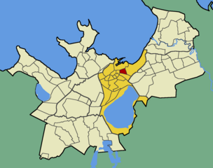
English: Map of Tallinn (Estonia) with borders of the quarters, Kesklinn district and Raua quarter emphasised |
| Datum | |
| Bron | Eigen werk |
| Auteur | Mmh |
Licentie
| Ik, de auteursrechthebbende van dit werk, geef dit werk vrij in het publieke domein. Dit is wereldwijd van toepassing. In sommige landen is dit wettelijk niet mogelijk; in die gevallen geldt: Ik sta iedereen toe dit werk voor eender welk doel te gebruiken, zonder enige voorwaarden, tenzij zulke voorwaarden door de wet worden voorgeschreven. |
Bestandsgeschiedenis
Klik op een datum/tijd om het bestand te zien zoals het destijds was.
| Datum/tijd | Miniatuur | Afmetingen | Gebruiker | Opmerking | |
|---|---|---|---|---|---|
| huidige versie | 23 okt 2009 17:17 | | 1.473 × 1.164 (53 kB) | Mmh | {{Information |Description={{en|1=Map of Tallinn (Estonia) with borders of the quarters, Kesklinn district and Raua quarter emphasised}} |Source={{own}} |Author=Mmh |Date=2009-10-22 |Permission= |other_versions= }} [[Category:Maps of Tallinn |
Bestandsgebruik
Dit bestand wordt op de volgende pagina gebruikt:
Globaal bestandsgebruik
De volgende andere wiki's gebruiken dit bestand:
- Gebruikt op de.teknopedia.teknokrat.ac.id
- Gebruikt op en.wikipedia.org
- Gebruikt op et.wikipedia.org
- Gebruikt op fi.wikipedia.org
- Gebruikt op fr.teknopedia.teknokrat.ac.id
- Gebruikt op ru.teknopedia.teknokrat.ac.id
- Gebruikt op sv.wikipedia.org
- Gebruikt op www.wikidata.org