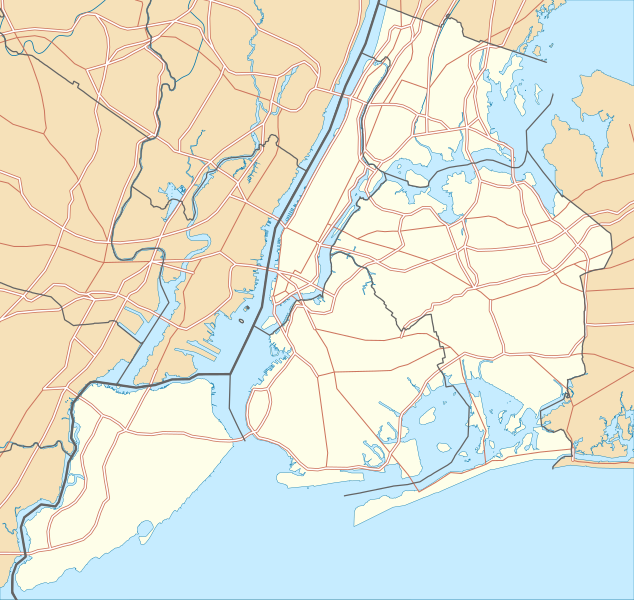
Afmetingen van deze voorvertoning van het type PNG van dit SVG-bestand: 634 × 600 pixels Andere resoluties: 254 × 240 pixels | 507 × 480 pixels | 812 × 768 pixels | 1.082 × 1.024 pixels | 2.164 × 2.048 pixels.
Oorspronkelijk bestand (SVG-bestand, nominaal 800 × 757 pixels, bestandsgrootte: 418 kB)
Bestandsgeschiedenis
Klik op een datum/tijd om het bestand te zien zoals het destijds was.
| Datum/tijd | Miniatuur | Afmetingen | Gebruiker | Opmerking | |
|---|---|---|---|---|---|
| huidige versie | 2 jan 2010 23:57 |  | 800 × 757 (418 kB) | Alexrk2 | roads under boundaries |
| 2 jan 2010 23:54 |  | 800 × 757 (418 kB) | Alexrk2 | changed road signature | |
| 2 jan 2010 14:25 |  | 800 × 757 (482 kB) | Alexrk2 | == {{int:filedesc}} == {{Information |Description= {{de|Positionskarte von New York City, USA}} Quadratische Plattkarte, N-S-Streckung 130.0 %. Geographische Begrenzung der Karte: * N: 40.92° N * S: 40.49° N * W: 74.27� |
Bestandsgebruik
Meer dan 100 pagina's gebruiken dit bestand. De volgende lijst geeft alleen de eerste 100 pagina's weer die dit bestand gebruiken. Er is ook een volledige lijst beschikbaar.
- 145th Street Bridge
- 53rd Street Tunnel
- 55 Hudson Yards
- 575 Madison Avenue
- 590 Madison Avenue
- 60th Street Tunnel
- 63rd Street Tunnel
- Aanslag in Manhattan op 31 oktober 2017
- African Burial Ground National Monument
- Alexander Hamilton Bridge
- Atlantic Terminal
- Battery Park City
- Bonwit Teller Building
- Bronx-Whitestone Bridge
- Brooklyn Bridge
- Brooklyn–Battery Tunnel
- Burnside Avenue (Jerome Avenue Line)
- Central Park (Manhattan)
- Central Park West Historic District
- Chelsea (Manhattan)
- Chinatown (New York)
- City Island
- Clark Street Tunnel
- Co-op City
- Coates Building
- Continental Center (New York)
- Cranberry Street Tunnel
- Davies Building
- Downtown Hudson Tubes
- Drake Hotel (New York)
- Dyckman House
- East Harlem
- East Village
- Forest Hills (Queens)
- Four Seasons Hotel New York
- Fuller Building
- General Motors Building
- George Washington Bridge
- Governors Island (New York)
- Green Flats (New York)
- Greenwich Village
- Hamilton Grange National Memorial
- Harlem
- Hart Island
- Hell's Kitchen (Manhattan)
- Hell Gate Bridge
- Henry Hudson Bridge
- High Bridge (New York)
- Holland Tunnel
- Inwood (Manhattan)
- Jackson Heights (New York)
- Jamaica Station
- Liberty Park (New York)
- Lincoln Tunnel
- Little Italy (Manhattan)
- Long Island City
- Lower East Side
- Lower Manhattan
- Manhattan Bridge
- Marble Hill (Manhattan)
- Meatpacking District
- Midtown Manhattan
- Montague Street Tunnel
- Moravisch Kerkhof
- Murray Hill (Manhattan)
- Museum of Arts and Design
- One New York Plaza
- Park Avenue Tower
- Parkchester (Bronx)
- Pelham Bay Park (park)
- Performing Arts Center
- Queens-Midtown Tunnel
- Queensboro Bridge
- Randalls and Wards Islands
- Rat Island (New York)
- Rolls Royce Building (New York)
- Roosevelt Island
- Roosevelt Island Bridge
- Saint Patrick's Cathedral (New York)
- SoHo
- Spuyten Duyvil
- St. John's University
- The Battery (New York)
- The Brooklyner
- The Dakota
- Throgs Neck Bridge
- Tiffany & Company Building (727 Fifth Avenue)
- Todt Hill
- TriBeCa
- Trump Tower (New York)
- Union Square (New York)
- Upper East Side
- Upper Manhattan
- Van Cortlandt Park
- Verizon Building
- Verrazzano-Narrows Bridge
- Washington Heights (Manhattan)
- Webster Hall
- Williamsburg Bridge
- Woodlawn Cemetery (Bronx)
Meer koppelingen naar dit bestand bekijken.
Globaal bestandsgebruik
De volgende andere wiki's gebruiken dit bestand:
- Gebruikt op als.wikipedia.org
- Gebruikt op ar.teknopedia.teknokrat.ac.id
- Gebruikt op arz.wikipedia.org
- Gebruikt op ast.wikipedia.org
- Gebruikt op az.wikipedia.org
- Gebruikt op ban.wikipedia.org
- Gebruikt op ba.wikipedia.org
- Gebruikt op be.wikipedia.org
- Gebruikt op bg.wikipedia.org
- Gebruikt op bh.wikipedia.org
- Gebruikt op bn.wikipedia.org
- টেমপ্লেট:তথ্যছক ঐতিহাসিক স্থান
- টেমপ্লেট:অবস্থান মানচিত্র মার্কিন যুক্তরাষ্ট্র নিউ ইয়র্ক সিটি
- অ্যাস্টোরিয়া, কুইন্স
- মেট্রোপলিটন মিউজিয়াম অব আর্ট
- ক্রাইসলার বিল্ডিং
- উলঅর্থ বিল্ডিং
- টেমপ্লেট:তথ্যছক ঐতিহাসিক স্থান/নথি
- মডিউল:অবস্থান মানচিত্র/উপাত্ত/মার্কিন যুক্তরাষ্ট্র নিউ ইয়র্ক শহর
- মডিউল:অবস্থান মানচিত্র/উপাত্ত/মার্কিন যুক্তরাষ্ট্র নিউ ইয়র্ক শহর/নথি
- ৮৬তম স্ট্রিট স্টেশন (সেকেন্ড অ্যাভিনিউ সাবওয়ে)
- ৯৬তম স্ট্রিট স্টেশন (সেকেন্ড অ্যাভিনিউ সাবওয়ে)
- লাগুয়ার্ডিয়া বিমানবন্দর
- ৫৭তম স্ট্রিট স্টেশন (আইএনডি সিক্সথ অ্যাভিনিউ লাইন)
- রুজভেল্ট আইল্যান্ড স্টেশন
- হিন্দু টেম্পল সোসাইটি অফ নর্থ আমেরিকা
- ৮৬তম স্ট্রিট স্টেশন (বিএমটি ফোর্থ অ্যাভিনিউ লাইন)
- ৯৬তম স্ট্রিট স্টেশন (আইআরটি ব্রডওয়ে–সেভেনথ অ্যাভিনিউ লাইন)
- Gebruikt op ca.wikipedia.org
- Gebruikt op ceb.wikipedia.org
Globaal gebruik van dit bestand bekijken.


