


Geen hogere resolutie beschikbaar.
Wpdms_usgs_photo_sacramento_delta_2.jpg (700 × 520 pixels, bestandsgrootte: 81 kB, MIME-type: image/jpeg)
Dit is een bestand van Wikimedia Commons.
Onderstaande beschrijving komt van de beschrijving van het bestand daar.
Onderstaande beschrijving komt van de beschrijving van het bestand daar.
| Beschrijving |
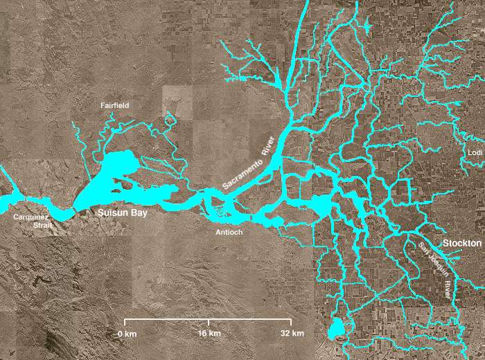
The Sacramento-San Joaquin River Delta of California - covering the right half of the map.
|
||||||||
| Datum | |||||||||
| Bron | http://en.wikipedia.org/wiki/Image:Wpdms_usgs_photo_sacramento_delta_2.jpg | ||||||||
| Auteur | Matthew Trump | ||||||||
| Toestemming (Hergebruik van dit bestand) |
English Wikipedia user Decumanus, de auteursrechthebbende van dit werk, maakt het hierbij onder de volgende licentie beschikbaar:
|
||||||||
| Andere versies | Afgeleide werken van dit bestand: California Grizzly Bear walking in the Delta Region.jpg |

en:Sacramento-San Joaquin River Delta
Bestandsgeschiedenis
Klik op een datum/tijd om het bestand te zien zoals het destijds was.
| Datum/tijd | Miniatuur | Afmetingen | Gebruiker | Opmerking | |
|---|---|---|---|---|---|
| huidige versie | 8 aug 2008 04:21 | | 700 × 520 (81 kB) | Captndelta | {{Information |Description=The Sacramento-San Joaquin River Delta covers the right half of this image. The Sacramento River flows into the delta from the north and the San Joaquin River from the south. The Mokelumne River |
Bestandsgebruik
Dit bestand wordt op de volgende 2 pagina's gebruikt:
Globaal bestandsgebruik
De volgende andere wiki's gebruiken dit bestand:
- Gebruikt op azb.wikipedia.org
- Gebruikt op de.teknopedia.teknokrat.ac.id
- Gebruikt op en.wikipedia.org
- Gebruikt op es.teknopedia.teknokrat.ac.id
- Gebruikt op eu.wikipedia.org
- Gebruikt op it.teknopedia.teknokrat.ac.id
- Gebruikt op ml.wikipedia.org
- Gebruikt op www.wikidata.org